
Search Forum
Blog Entry# 141357
Posted: Apr 18 2011 (16:59)
8 Responses
Last Response: Apr 18 2011 (17:45)
8 Responses
Last Response: Apr 18 2011 (17:45)

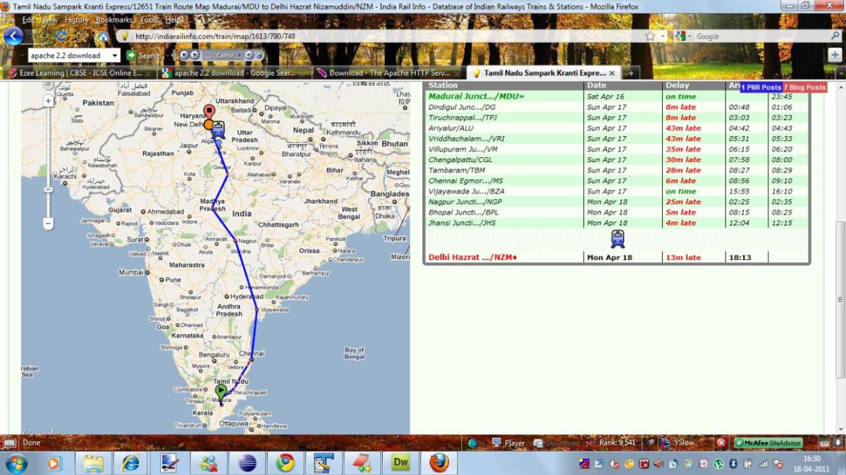
In Rail map section, the rail map is shown according to the stoppages. Here, I am attaching a pic, according to which TN SK passes through sea.
I understand it is not easy to plot the map easily, but if we can generate some stations in between (not visible to anyone else) for proper route mapping, then it could help people better.
3 Posts
Thanks a lot.
Anyways, Congrats SGP for becoming youngest admin of our site....
Anyways, Congrats SGP for becoming youngest admin of our site....
These indication on the maps does not include the exact route inch by inch but indicates the stoppages. Hence the straight lines are connecting two halts on telescopic basis.
Thanks. And I am also waiting for that feature desperately. Moderator recently announced that he was combining the living atlas with train map but some problem occurred in between (notable the Selu and Tirupati issue refer /blog/post/133961).