Spotting
 Timeline
 Travel Tip
 Trip
 Race
 Social
 Greeting
 Poll
 Img
 PNR
 Pic
 Blog
 News
 Conf TL
 RF Club
 Convention
 Monitor
 Topic
 #
 Rating
 Correct
 Wrong
 Stamp
 PNR Ref
 PNR Req
 Blank PNRs
 HJ
 Vote
 Pred
 @
 FM Alert
 FM Approval
 Pvt

RailCal app

site support

The train is a small world moving through a larger world - Niraj Kumar

Search Forum
<<prev entry    next entry>>
Blog Entry# 2241774
Posted: Apr 19 2017 (12:45)

39 Responses
Last Response: Apr 23 2017 (17:21)
General Travel
54453 views
7

Apr 19 2017 (12:45)  
rahulkumarjain^~
rahulkumarjain^~   16467 blog posts
Entry# 2241774              
New atlas is awesome but no press release from mod. I mean no post regarding such huge change
also how to look into satellite imaginary of that.
Translate to English
Translate to Hindi

3 Public Posts - Wed Apr 19, 2017

1061 views
9

Apr 20 2017 (00:03)
moderator^~   16738 blog posts
Re# 2241774-8               Past Edits
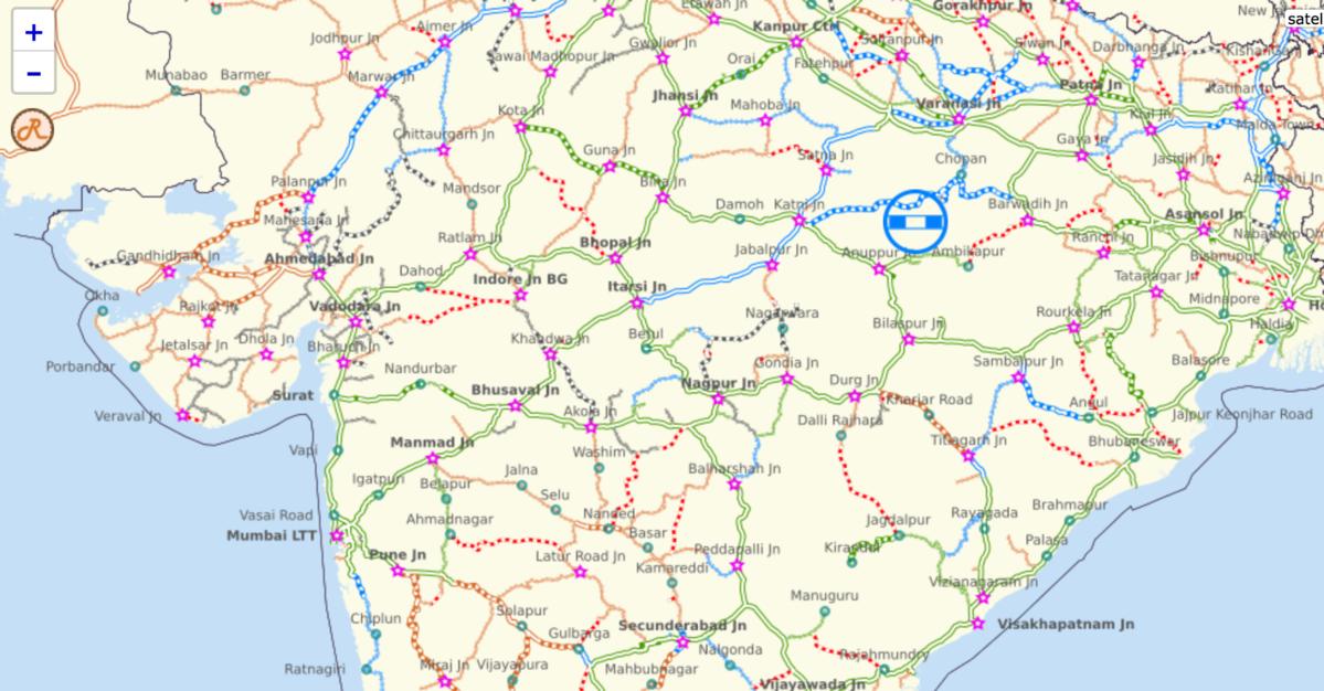
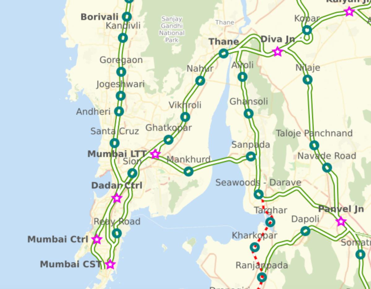
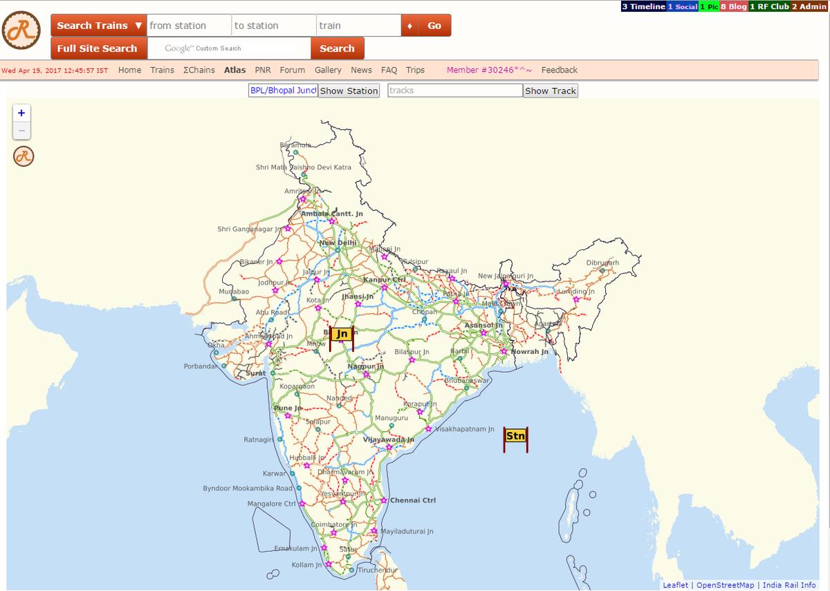
Thanks for noticing. Yes, the Atlas infrastructure has been completely overhauled. The base map is now specifically tailored to IRI, focusing on and highlighting Tracks and Stations, rather than extraneous details like rivers, buildings, hotels, etc. This makes the Atlas light-weight and fast-loading - requiring low bandwidth and minimal processing power. As you zoom into the map, you will see more stations coming into the map - corresponding to the resolution. All tracks and stations are visible directly in the Atlas - visibility depending on the location/zoom level. You may click on any station or track, to view further details. You may also use the Station/Track filter boxes to zoom directly into the Station/Track. A Satellite view switch will also soon be added for seamless switching between map and satellite views.
.
...
more...

All the previous info is also present. As for concerns regarding the borders of J & K, country shape info is acquired from the OpenStreetMap project which, like Wikipedia, is a world-wide, collaborative open community. (see Pic #3). Our members are free to go to OpenStreetMap and alter the shape of India, and the same will also thereafter be reflected in IRI.
.
Coming up soon:
1. Much more railway/IRI information - Bridges, PRS Counters, RF Spots, Our member favourites, will be incorporated directly into the base Atlas.
2. A completely Hindi version of the base Atlas.
3. A colourful Zone Map/Division Map - edited by our members - will be added to the Base Atlas.
4. Metro Maps will be directly added to the base map, and will be available through filters at higher zoom levels.
5. Station schematics showing platforms, junction points, etc. will also be directly added to the Atlas.
6. A light-weight completely offline version of the map will be available on the IRI mobile app - RailCal. The same can be used for Trip Diaries.
.
Further suggestions/feedback are welcome. Thanks.

Translate to English
Translate to Hindi

25 Public Posts - Thu Apr 20, 2017

6 Public Posts - Fri Apr 21, 2017

2 Public Posts - Sat Apr 22, 2017

2 Public Posts - Sun Apr 23, 2017
Scroll to Top
Scroll to Bottom
Go to Desktop site
Important Note: This website NEVER solicits for Money or Donations. Please beware of anyone requesting/demanding money on behalf of IRI. Thanks.
Disclaimer: This website has NO affiliation with the Government-run site of Indian Railways. This site does NOT claim 100% accuracy of fast-changing Rail Information. YOU are responsible for independently confirming the validity of information through other sources.
India Rail Info Privacy Policy